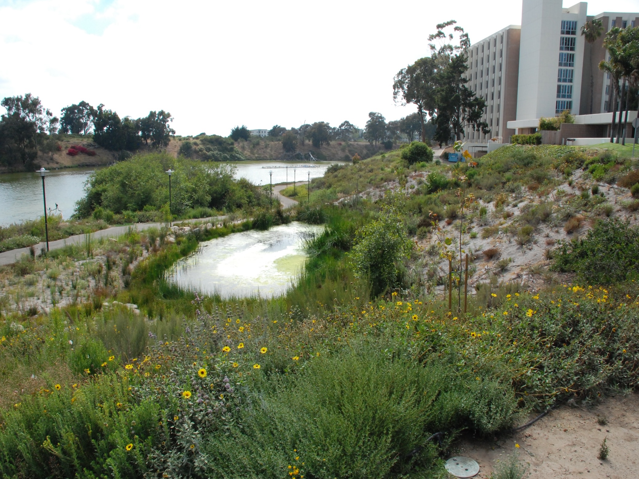
The Campus Lagoon currently maintains stable water levels with weirs. The Lagoon receives water inputs from 8 storm drains, surface flows, and seawater from the marine science laboratories and aquaria. A combination of mitigation funding for the UCEN expansion and funding from Housing and Residential Services have contributed to several large restoration projects in and around the lagoon including the creation of salt marsh islands and shallow areas for shorebirds as well as the freshwater habitats adjacent to Manzanita Village. The Coastal Fund has supported the restoration of more than 6 acres of coastal sage scrub, coast live oak woodland, and two acres of dune habitat. Current activities include the enhancement of water quality by creating freshwater wetlands and continued restoration of coastal sand dunes, coastal sage scrub, and coast live oak woodland.
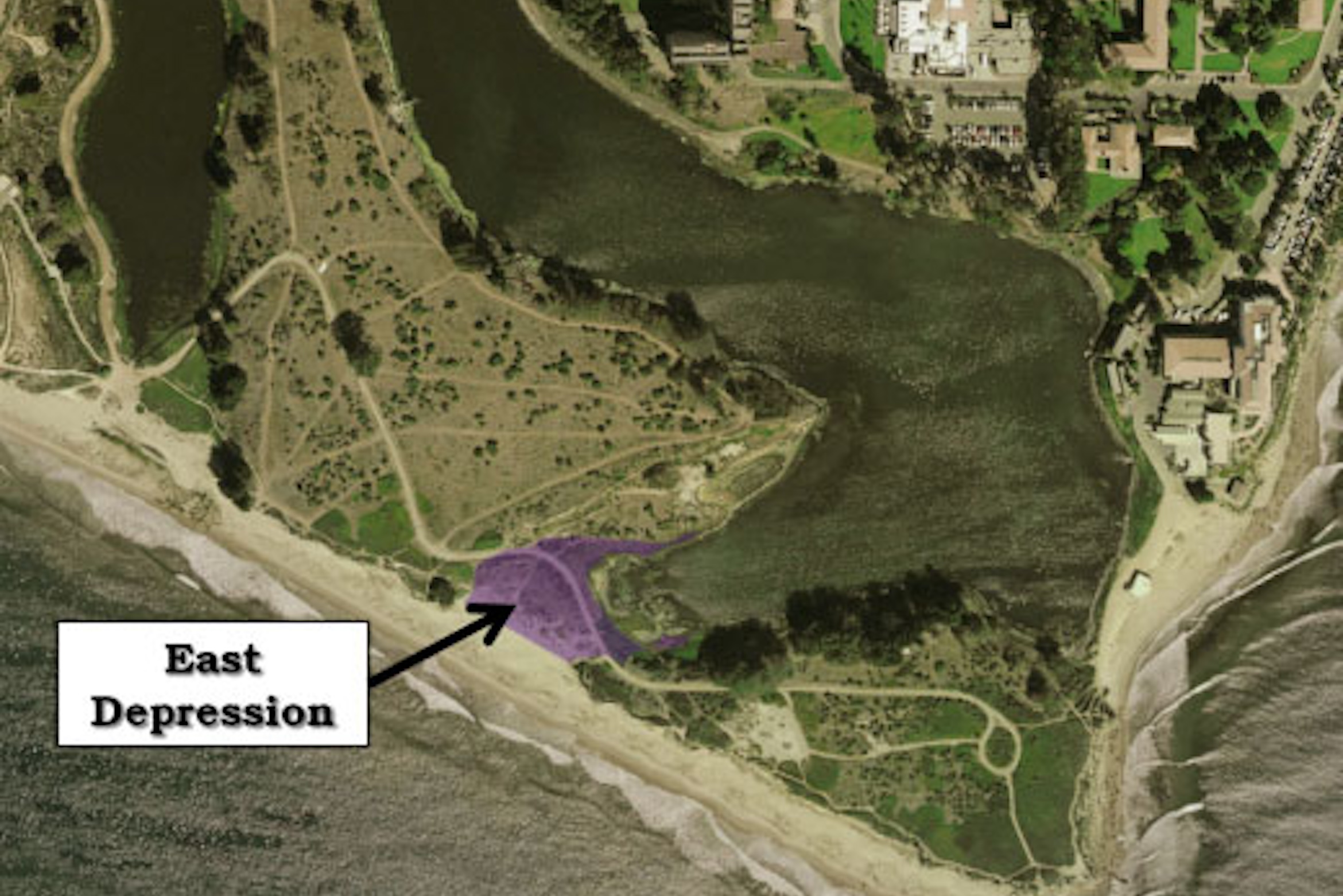
East Depression
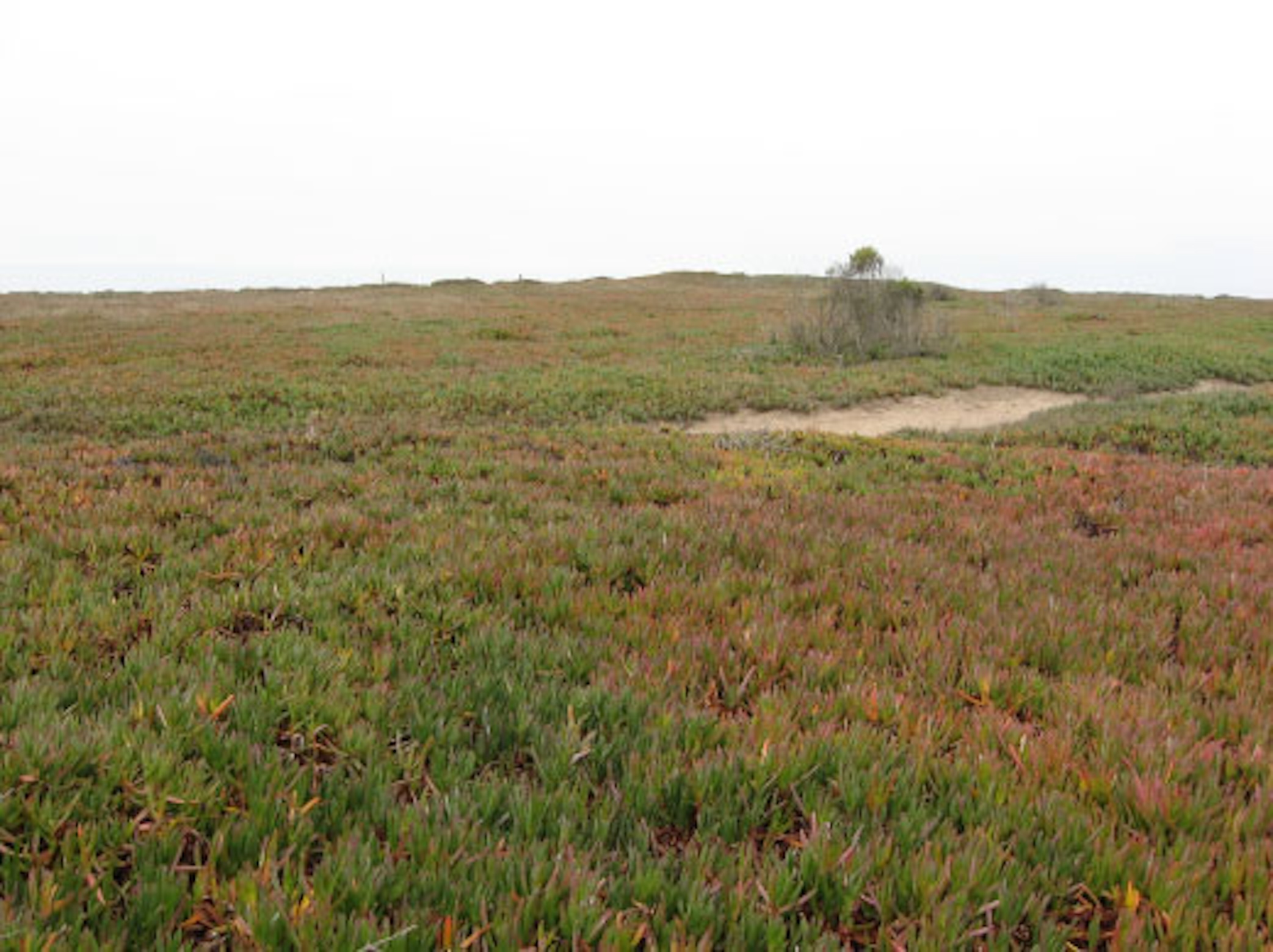
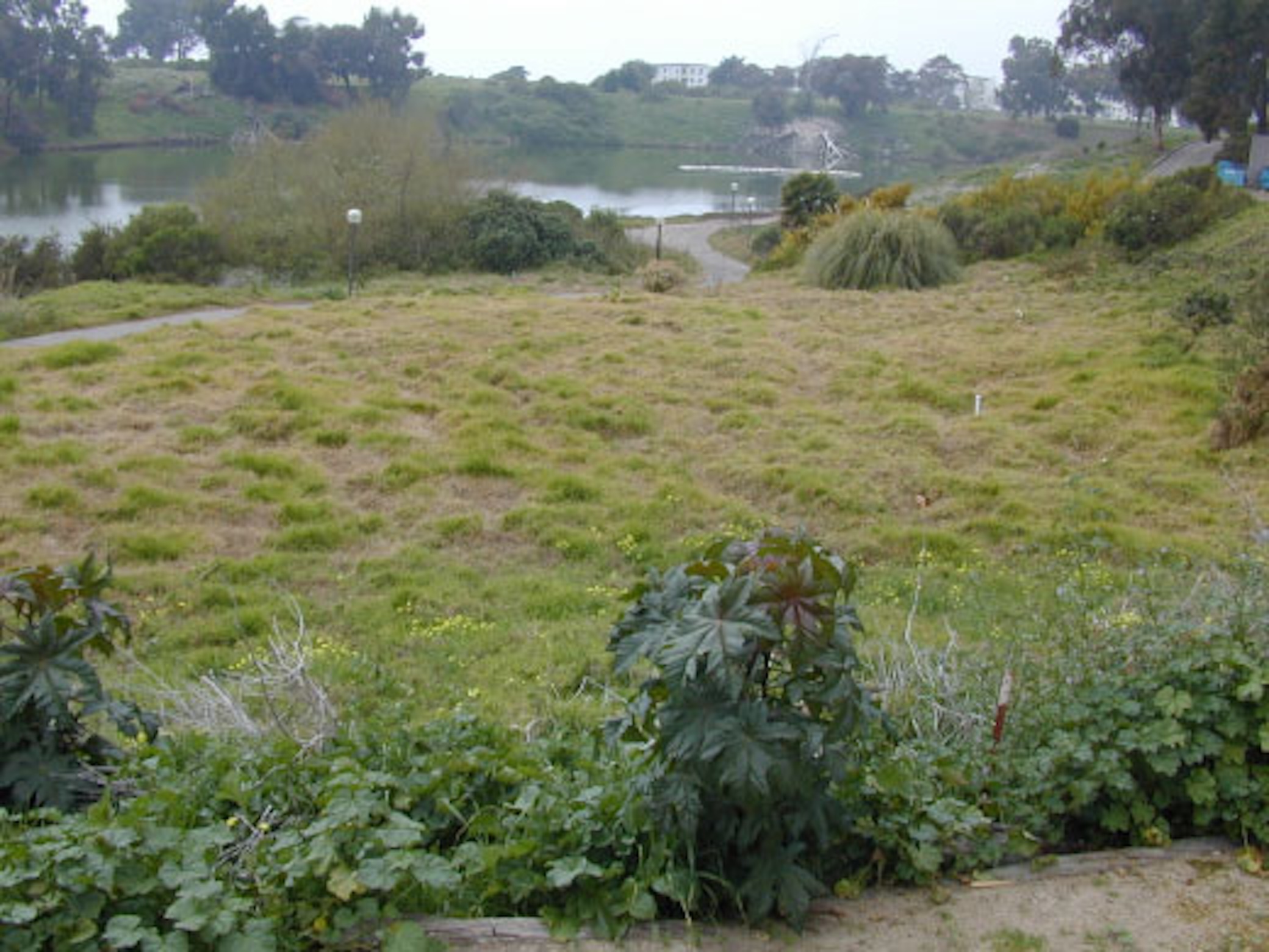
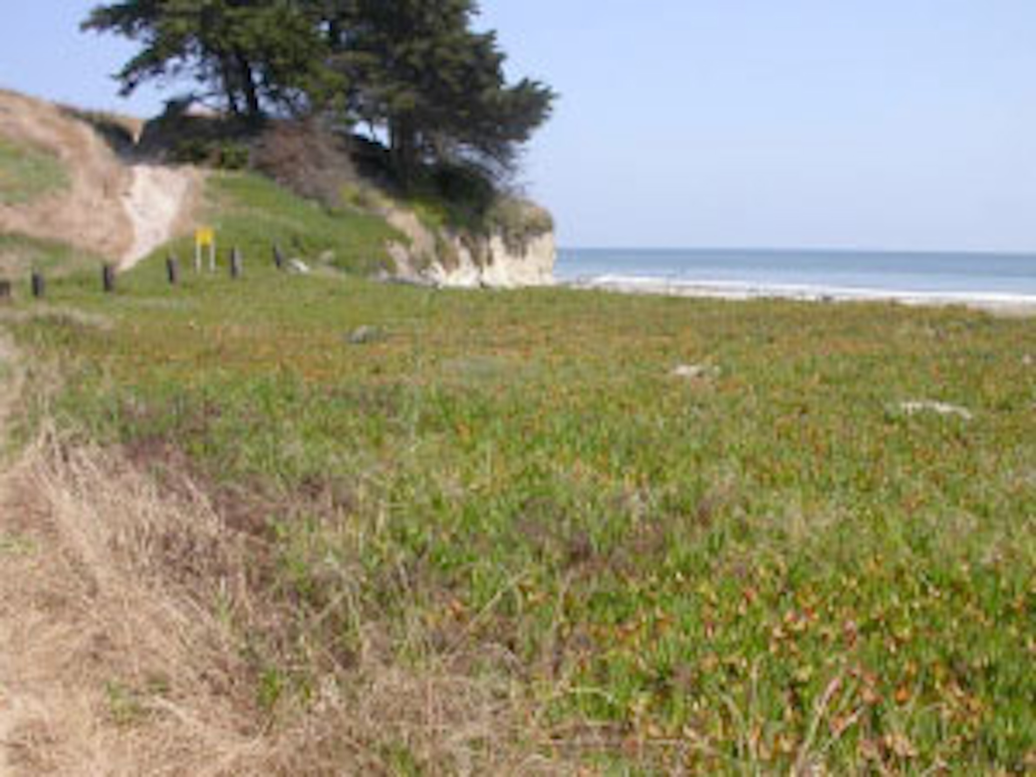
East Depression is a 1-acre coastal dune site that connects UCSB's Campus Point and Lagoon Island. It is bordered on the north by the Campus Lagoon and on the south by the Santa Barbara Channel. The site consists of several distinct habitats including salt marsh, coastal scrub, coastal foredune, dune swale, coastal strand, and sandy intertidal. In 2000 the dune areas of the site were covered almost entirely by non-native invasive iceplant (Carpobrotus edulis). The spread of this thick mat-forming ice plant on the site had impaired the natural dune-forming and shaping processes that are characteristic of coastal dune habitats by stabilizing the slope and impeding sand transport. Thus, the dunes at East Depression were artificially steep and stable compared to undisturbed coastal dunes.
Restoration of this area was conducted in 2000 and 2001 as a year-long Environmental Studies course. Manual removal and 'solarization' of ice plants began in the fall of 2000 and continued into the winter and spring of 2001. Solarization is a process in which black plastic is placed over the ice plant to trap heat and block sunlight. The ice plant was replaced with native plants that were grown at the Cheadle Center Native Plant Nursery from seeds collected from local reference sites.
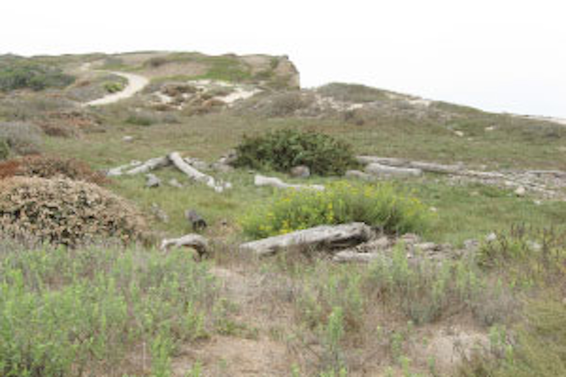
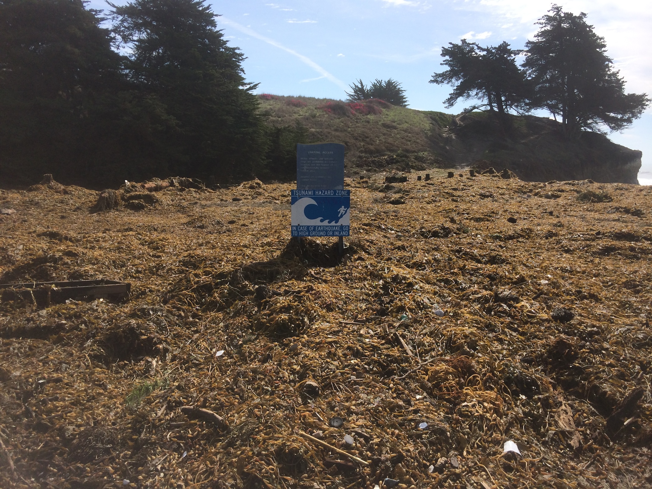
Like the West Depression site, this site has been shaped by two large disturbance events. In December 2005 and again in January of 2008, extremely high tides and big waves brought in by large storms flooded the low-elevation areas of the site bringing in large amounts of driftwood and seaweed wrack. After the 2005 event much of the debris was piled into tarps and dragged offsite, however; after the second storm in 2008 it was decided that these periodic disturbances are a part of the natural cycle of dune systems and the woody debris was left in place. The influx of salt water and debris caused a change in the species composition of the affected areas. Low areas that were once covered with several dune species including California poppies (Eschscholzia californica) and bush lupine (Lupinus arboreus) became dominated by salt grass (Distichlis spicata). However, in 2009, diversity appeared to be beginning to increase.
East Depression pre-restoration covered in iceplant.
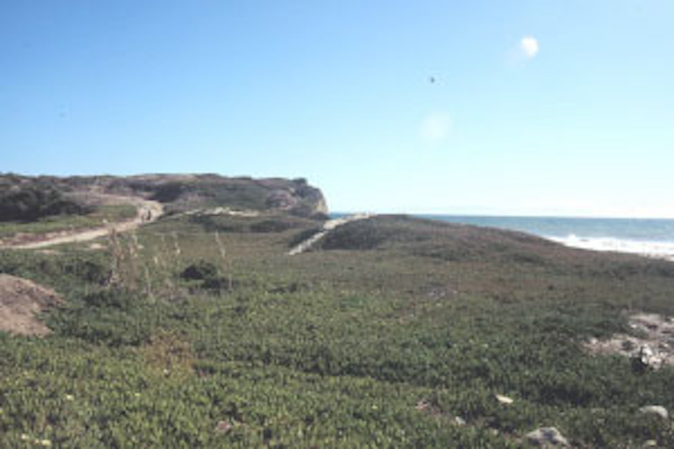
East Depression post restoration with native plants and grasses.
In 2007, ice plants and non-native grasses were removed from the eastern and southern edges of the lagoon at the East Depression site. The ice plant in this area was controlled by a method called solarization in which sheets of black plastic are placed on top of the ice plant for several months during the summer and fall. The black plastic traps the heat and moisture and blocks sunlight, causing the plants to die. We discovered that the solarization process killed the ice plant but allowed the native salt marsh species being suppressed by the ice plant, Jaumea carnosa and Frankenia salina, to persist and eventually dominate. These areas were also planted with native salt marsh, coastal scrub, and dune species depending on the elevation and soil salinity.
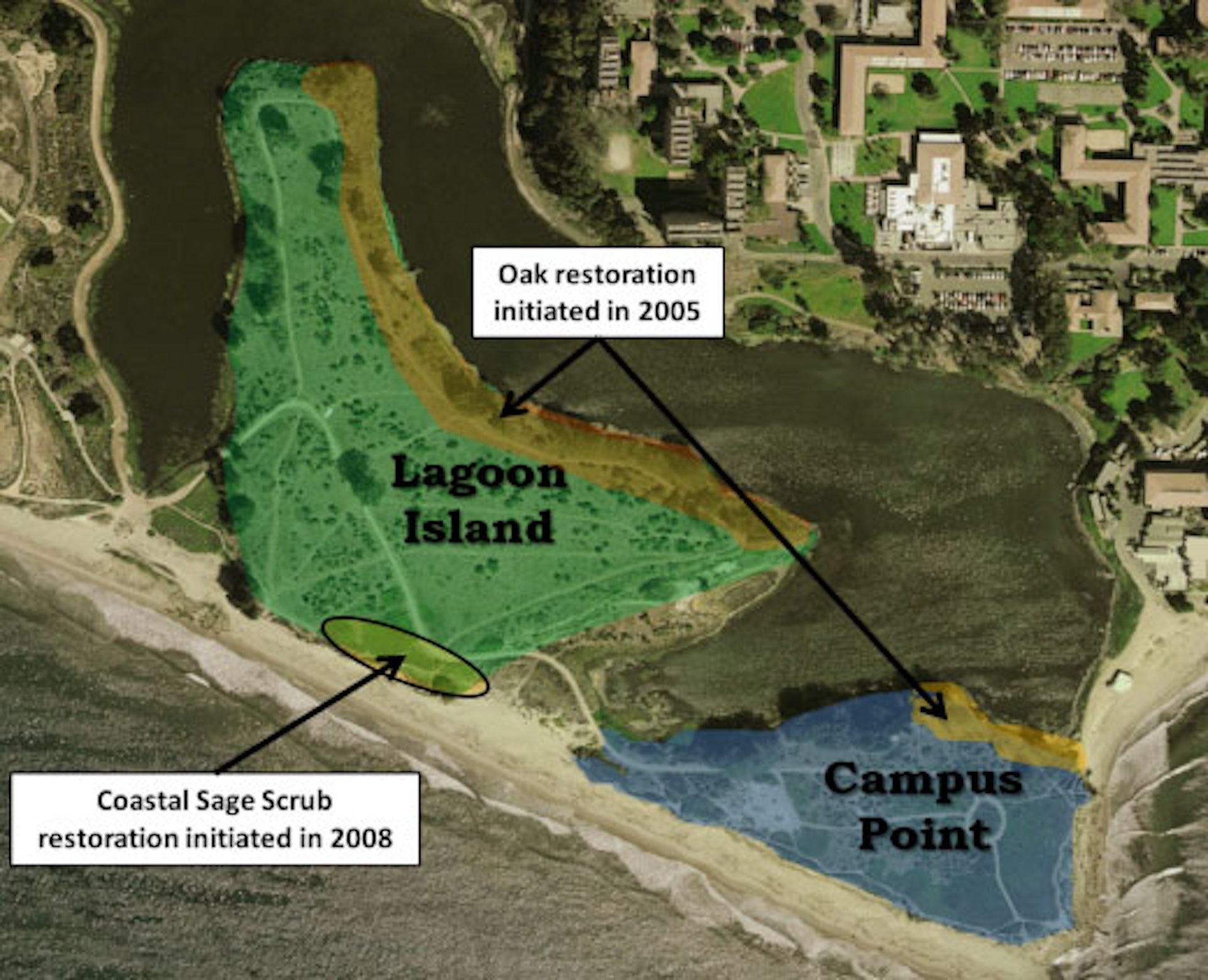
Lagoon Island & Campus Point
Lagoon Island and Campus Point are coastal mesas situated between the UCSB campus lagoon and the Santa Barbara Channel. These sites are characterized by nearly vertical bluffs on their oceanward side and steep vegetated slopes that descend into the campus lagoon. These areas have been the site of several restoration and research projects including coastal sage scrub restoration, experimental controlled burning to remove invasive brome grass, and oak woodland restoration.
Coastal Sage Scrub Restoration
Much of Campus Point is covered with ice plant (Carpobrotus edulis), an exotic succulent that competes with native plants by forming thick mats that cover the landscape. Where iceplant is not abundant, the dominant species are the exotic rip-gut brome grass (Bromus diandrus), native coyote brush (Baccharis pilularis), and ragweed (Ambrosia psilostachya). Ice plant removal and coastal sage scrub restoration are planned for this area.
The lagoon Island site is largely dominated by exotic rip-gut brome grass (Bromus diandrus). Other exotic weeds that are abundant include wild radish (Raphanus satirus), scarlet pimpernel (Anagallis arvensis), Eucalyptus species, and sheep sorrel (Rumex acetosella). In 2008, the bluff-top at the southern edge of Lagoon Island was covered entirely with iceplant. This area was covered with black plastic from August to December 2008 to solarize the ice plant. Solarization is a process that kills the ice plant by trapping heat and blocking sunlight. Native coastal scrub species were planted on the bluff during the winter of 2009. Additional restoration activities taking place on Lagoon Island include planting oaks on the north-facing slopes and experimentation with prescribed burns to control the rip-gut brome grass.
Iceplant covering lagoon island before restoration.
Oak woodland restoration at the lagoon.
Oak Woodland Restoration
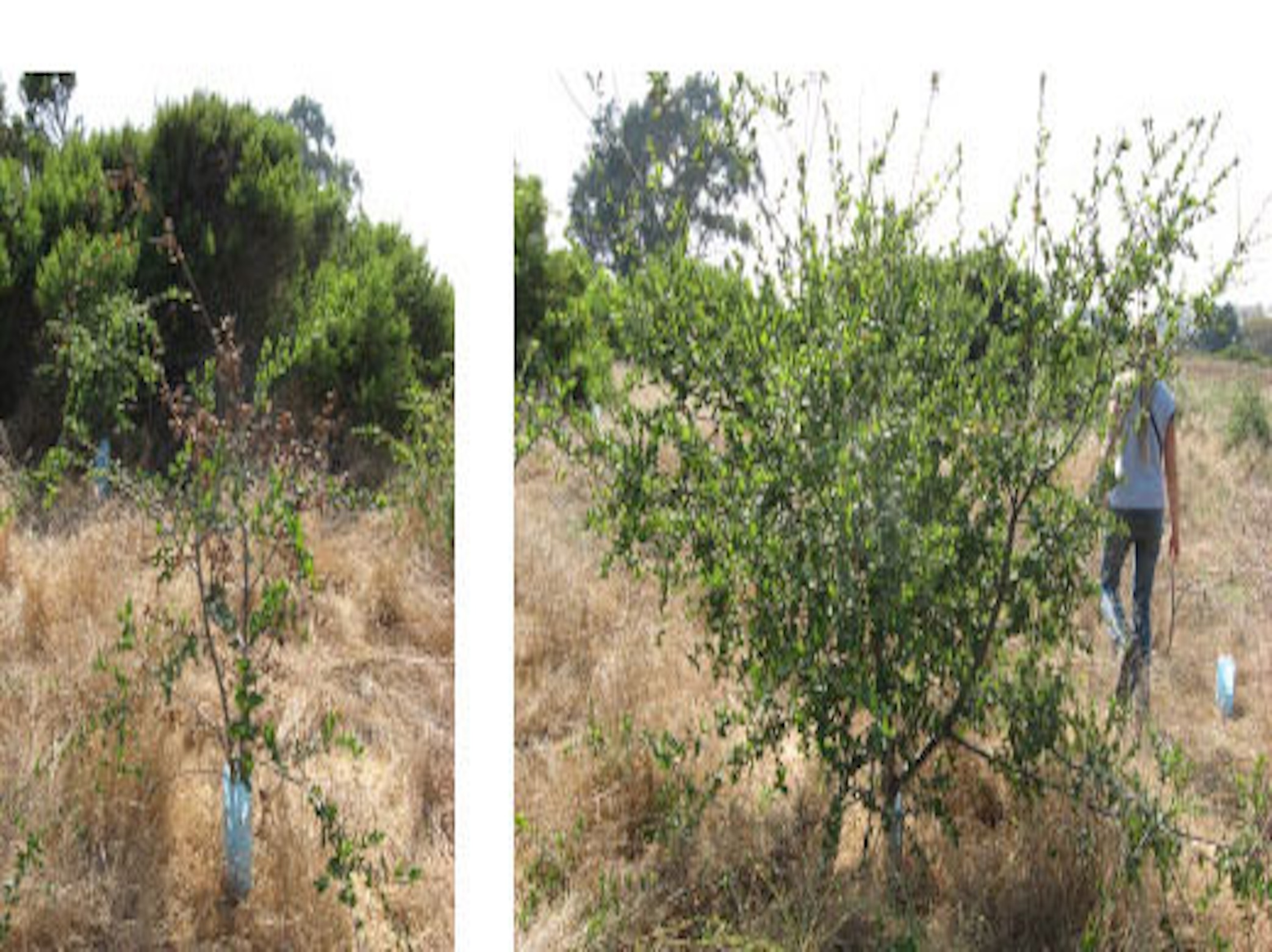
Based on historic maps, it is thought that much of UCSB was once oak woodland. The earliest map of this area is from 1871 and shows a large oak woodland covering what is now the northwestern portion of UCSB's main campus. A few large oaks in this area of the campus, like the one next to the Recreation Center, are thought to be remnants of this the oak woodland. Based on the sharp straight contours of the mapped oak woodland and knowledge that much of the area was deforested in the 1800's by ranchers and the whaling industry, we believe that this oak woodland area extended much further and may have covered most of the UCSB campus. In 2006, the Cheadle Center sought to recreate the oak woodland habitat that once existed on the UCSB campus by planting nearly 2000 acorns along the north-facing slopes of Lagoon Island and Campus Point with the hope that in 15 to 20 years a small oak woodland habitat will be established.
Experimental Controlled Burning
Restoration research currently taking place on Lagoon Island involves experimentation with controlled burning to remove a non-native annual grass (Bromus diandrus) that dominates much of the site. This research began in 2006 as a master's project by a UCSB graduate student who was interested in using fire as a tool for restoration. The project aimed to efficiently control Bromus diandrus by reducing its seed bank using high-intensity burns. The project showed promising results for restoration and is now being continued by the Cheadle Center as a management strategy for efficiently controlling exotic grasses on the site.
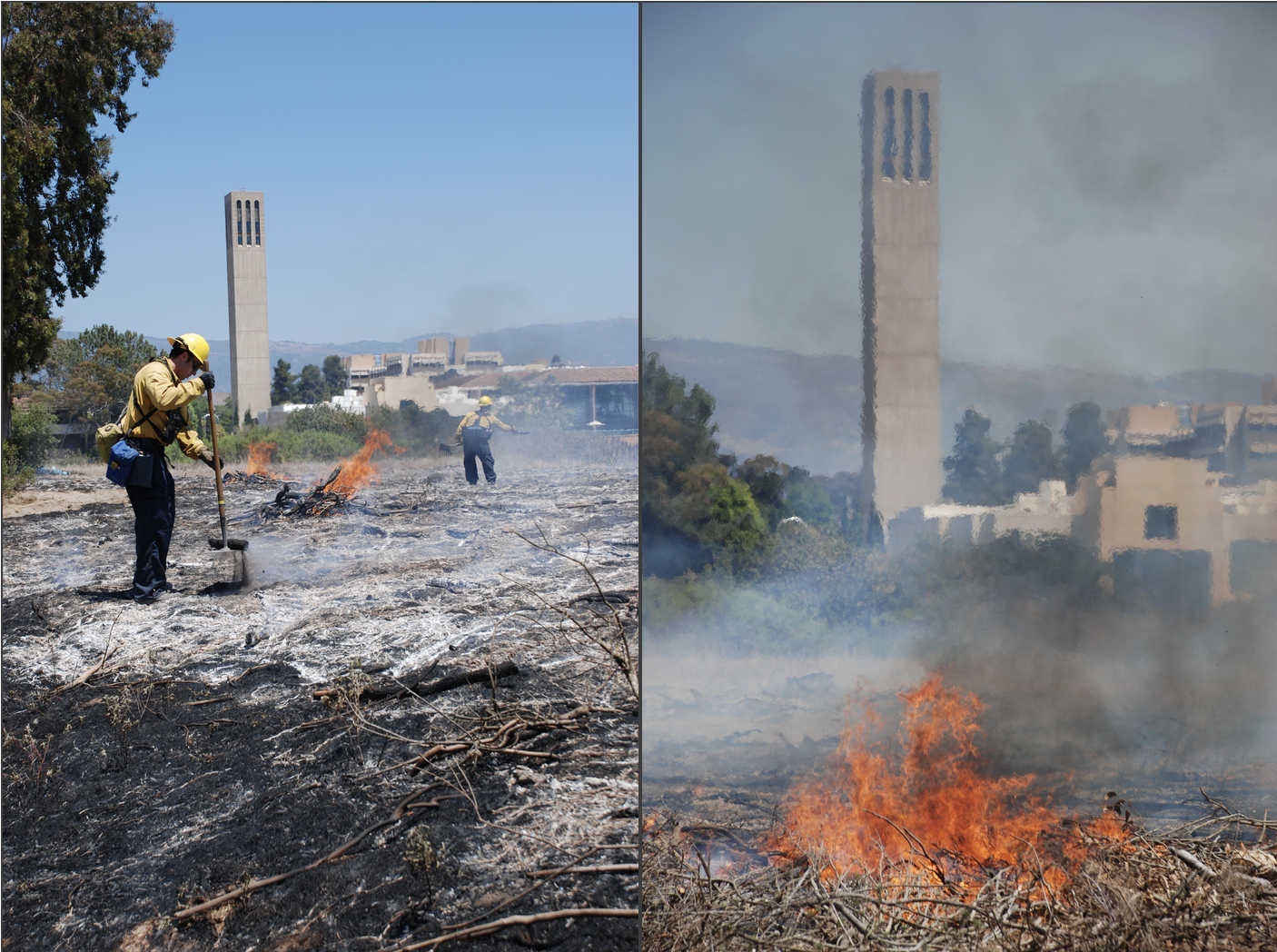
Santa Barbara County Fire Department hot shots managing a prescribed burn.
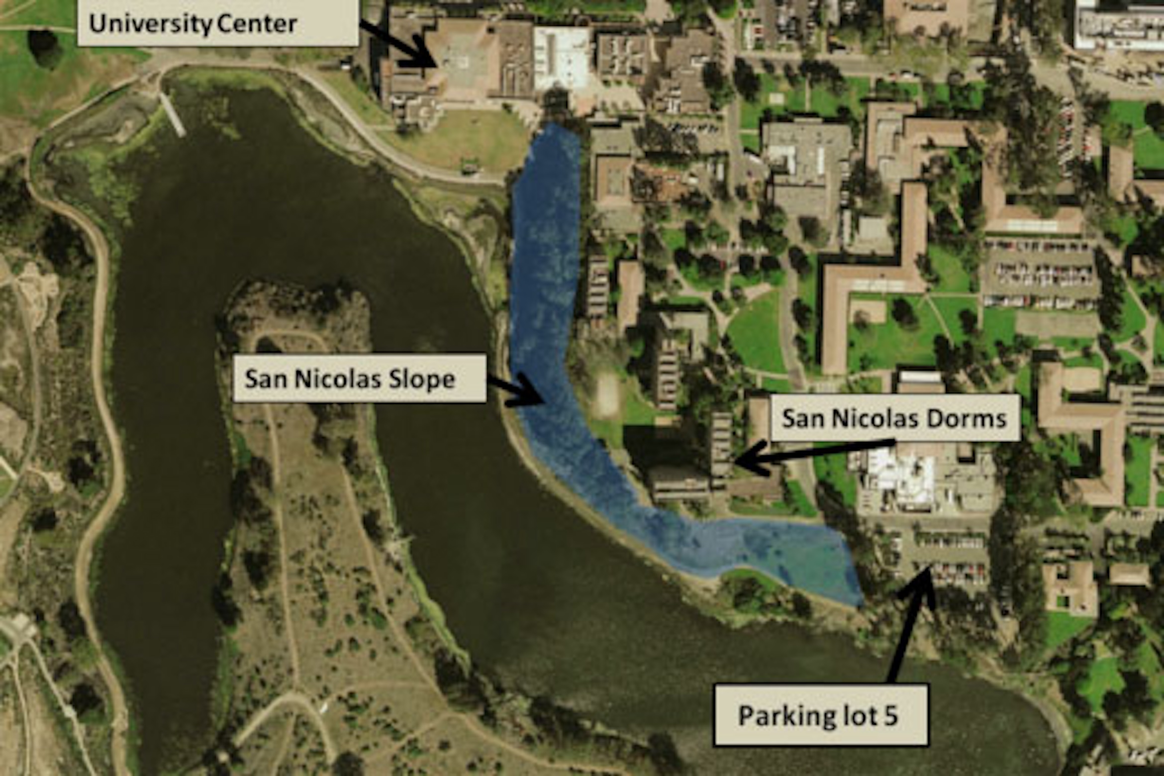
San Nicolas Slope
As part of the mitigation for the construction of the University Center, the lower portions of the slope were planted with native species from 1995 through 1998. These areas are now well established with native coastal sage scrub species such as Lemonade Berry (Rhus integrifolia), California sunflower (Encelia califorinica), and California Sage Brush (Artemisia californica). Much of the upper portion of the slope is shaded by a windrow of Eucalyptus trees. Eucalyptus leaf litter exudes chemicals that alter the soil and hinder the growth of native plants. Areas under the Eucalyptus canopy were covered in leaf litter and sparse patches of exotic annual grasses.
In 2008 and 2009 the Cheadle Center planted native coastal sage scrub species along the upper portion of the slope. Establishment of these plants was most successful in areas where Eucalyptus canopy cover was low or absent, while areas with high canopy cover had very low establishment.
The southernmost portion of the site was covered entirely in Kikuyu grass (Pennisetum clandestinum), a mat-forming rhizomatous grass. Hydrology studies of this portion of the site have shown that freshwater seeps into this area and is held very close to the surface (only a couple of inches below the surface soil); thus, the Cheadle Center created a native freshwater wetland following the removal of the Kikuyu grass.
San Nicolas slope before restoration.
San Nicolas slope after restoration.
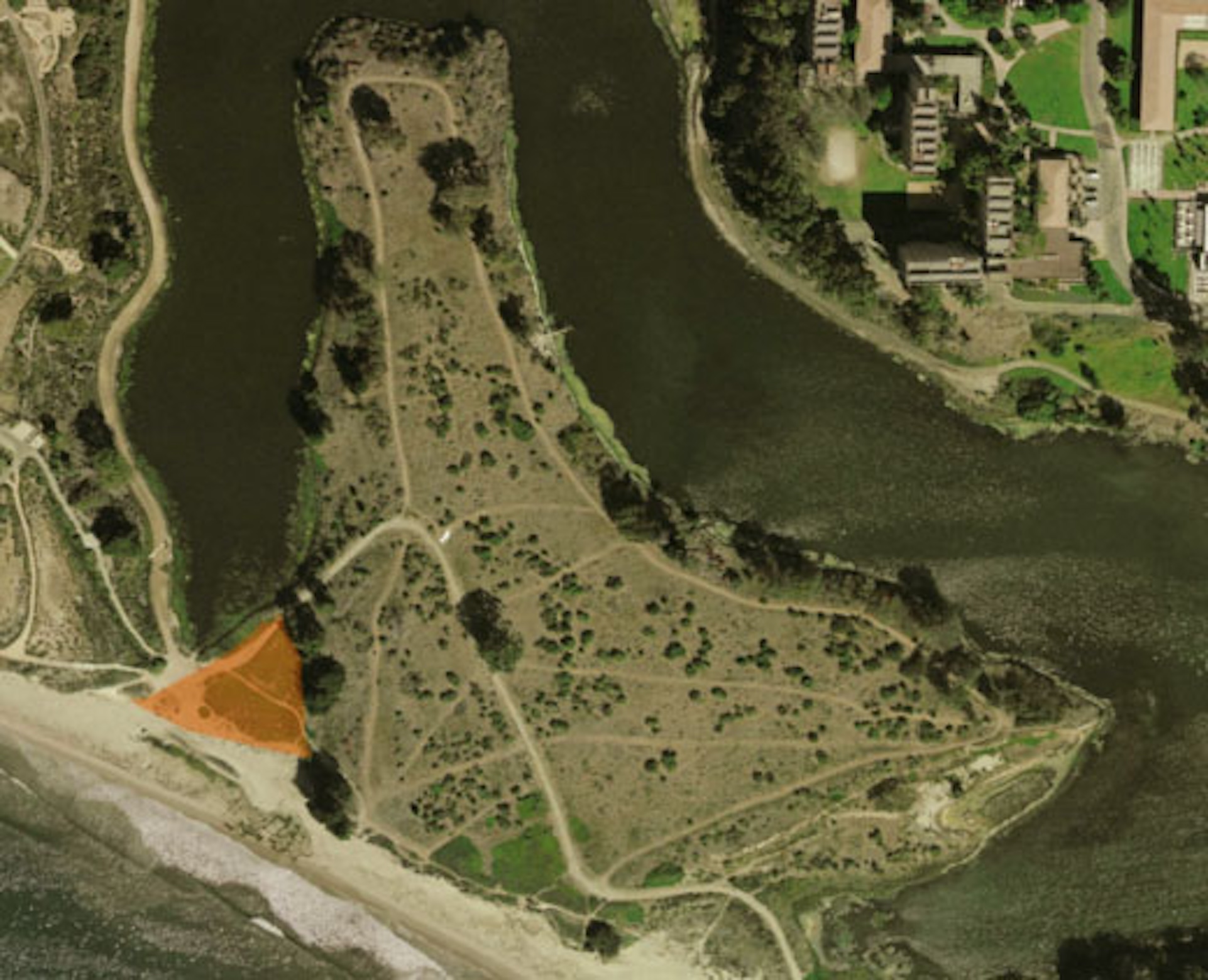
West Depression
West Depression is a 1-acre coastal dune habitat area between the Manzanita Village restoration site and Lagoon Island. The primary outfall from the Campus Lagoon is from a weir that conveys water underneath West Depression into an outfall box on the beach.
In 2005 the site was relatively flat with very little topographic variation and completely dominated by iceplant (Carpobrotus edulis) with native dune and salt marsh plants along the more extreme margins and intermittent patches of non-native ripgut brome (Bromus diandrus) throughout the site. Iceplant was controlled by the method of 'solarization' using sheets of black plastic (6 mm thick) to trap heat and moisture and block sunlight from August - December 2005. Native species were seeded and planted during the winter and spring of 2006 into three habitat zones created as part of the project: coastal dunes, coastal sage scrub, dune swale, coastal strand, and salt marsh.
Extensive hand-weeding of ripgut brome grass (Bromus diandrus) was required during the spring and summer of 2006 in order to decrease competition to native plant establishment and keep the non-native grasses from setting seed. Species diversity on the site has increased from an ice plant monoculture to a diverse native-dominated plant community with over 35 native species. Significant natural events have affected the site and reflect a regime of disturbance characteristic of coastal dune sites. Namely, high tides and large wave events coincided on December 21st, 2005, and in January 2008. These events brought in huge quantities of seaweed and wracks of driftwood and giant reed, Arundo donax, along with pulses of seawater. The first event occurred when the black plastic was still covering the ground, so in the process of using heavy equipment to unearth the plastic some topography was created to form a shallow swale that favors salt marsh vegetation and some small foredunes which support a variety of dune species. The 2008 event brought a seawater and driftwood pulse which partially leveled the foredunes and altered the soil salinity so that several coastal sage scrub species, such as Artemisia californica and Encelia californica, died. The result is that the ocean side of the project has been re-set to an early successional stage in dune formation dominated by beach saltbush (Atriplex leucophylla) and beach bur (Ambrosia chamissonis). Interestingly, historically such intense storm events are not common; in fact, the 2005 event was the first time in 25 years that high tides and waves from a storm had breached the lagoon. It is unusual that these two storm events occurred so close together.
West Depression before restoration.
The West Depression after a high tide event.
Want to learn more about restoration, native habitats, and plants?
All Cheadle Center restoration monitoring reports, databases, and referenceable data are stored in the Cheadle Center eScholarship repository and can be accessed through our Data and Research Resources page.
To learn more about our native habitats and plants visit the Native Plants & Habitats of the UCSB Campus page or explore the PDFs of each site's species list below.
 East Depression Species List
 Lagoon Island and Campus Point Species List
 West Depression Species List